Geo Precision: Unifying Land & Building Surveys with GIS Intelligences
- 12 June,2025
- 5 min read
Understanding Drone Survey Technology
GIS Mapping for Land Surveys
Applications of Drone Surveys
- 4.1 Topographical Surveys Using Drones
- 4.2 Land Boundary Surveys Using Drones
- 4.3 Aerial Mapping with Drones
GIS and Drone Integration: A Game Changer
Benefits of Using Drones and GIS for Surveying
Conclusion
Introduction
In today's tech-friendly era, both drone survey technology and Geographic Information Systems have become indispensable for land surveying. The former, equipped with advanced sensors and high-resolution cameras, captures aerial imagery before converting it into georeferenced datasets for GIS platforms. The latter provides a framework for managing, collecting, and analyzing spatial data. Together, both tools develop a vibrant and dynamic partnership that enhances the accuracy and speed of data collection and analysis. Delve into this blog to learn about top drone and GIS technology applications in land surveys.
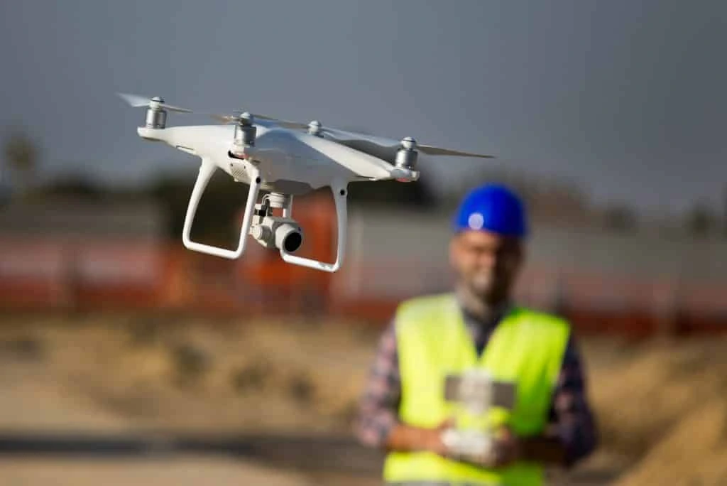
Understanding Drone Survey Technology
You must have heard an old proverb, "Necessity is the mother of invention.” Because of this necessity, technologists have developed drone survey technology to maintain accuracy in land surveying. This tool uses unmanned aerial vehicles to accumulate data and create models, maps, and 3D representations of the land. Being equipped with cameras, sensors, and GPS, it accesses faraway locations, such as swamps, rocky terrain and marshes. Because of its high utility, it has taken precedence over traditional land surveying.
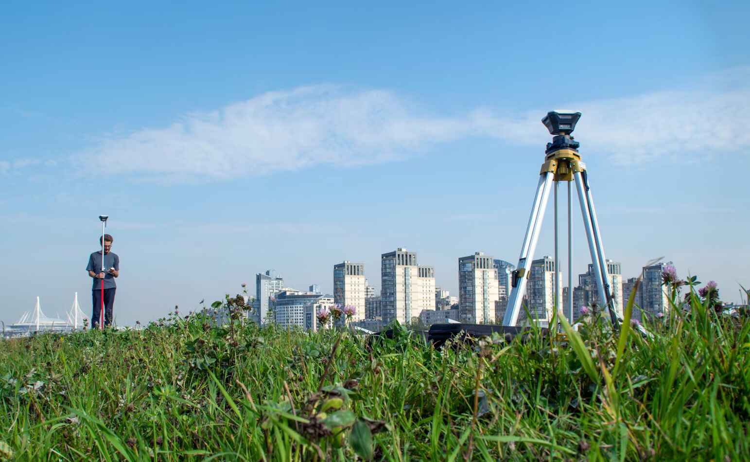
GIS Mapping for Land Surveys
GIS mapping for land surveys employs a method to collect, analyze and display spatial data about a particular land in a visual format. GIS combines data from a database with a map to show descriptive information or location data. It manages, analyses, captures, and displays geospatial data. In addition, it is used to enhance survey accuracy and lessen costs. It helps surveyors manage survey information and provide the required data for projects; identify potential risks or hazards, such as landslides or floods; and give them information about land use and development.
Applications of Drone Surveys
- Topographical Surveys Using Drones: A topographical survey using a drone is a system to gather data about a land's surface and elevation with an unmanned aerial vehicle. Then, this data is used to create a 3D model of the area.
- With sensors and cameras, the drone collects data and images about the land. Specialized software uses the images to create a 3D model of the area. Drones are much faster than traditional methods. They can be used in risky areas that traditional methods cannot access. They are less expensive than traditional methods and are highly accurate. Their varied applications include the following:
- Land development: They are used to survey land development sites.
- Agriculture: They are used to survey forests and agricultural land.
- Mining: They are used to survey quarries and mines.
- Construction: They are used to survey construction sites.
Land Boundary Surveys Using Drones: A land boundary survey using a drone is also called drone mapping. It uses a UAV to capture pictures of land and create a 3D model. This type of survey is appropriate for challenging terrain that is difficult to reach. When it comes to its working, an operator flies it over the land. It takes hundreds of pictures. Computer software layers the images to create a 3D model of the area.
Drones capture data faster than traditional surveying methods. They provide high-resolution images and precise vertical and horizontal information. It has the following limitations:
- Regulations: Drones cannot be flown in crowded and overpopulated areas, near airports, or over military bases.
- Hijacking Risks: They can be easily manipulated or hijacked.
- High Winds: They are deflected by high winds, which prevent them from getting accurate results.
- Aerial Mapping with Drones: Also called aerial surveying or drone mapping, aerial mapping with drones is a remote sensing technology that employs drones to draw 2D and 3D maps for a particular area. These maps are used for urban planning, agriculture, land surveying and construction applications.
- With lidar and cameras, drones fly above the area being mapped. They take overlapping images. Their software stitches the images to create a map, which includes real-world location coordinates for each data point. They are safer and faster than traditional methods. They are affected by high winds and can be hijacked. So, trained pilots fly them. There are certain regulations under which drones are flown.
GIS and Drone Integration: A Game Changer
- GIS and drone integration is a game changer for data collection, visualization, and analysis. Drones gather high-resolution data efficiently, accelerating the mapping speed and enhancing accuracy. They are also used for real-time data acquisition and analysis, which help with decision-making and emergency response.
- Drones cover large areas quickly, saving more time than other traditional methods. Their cost of data collection is less than other methods. They navigate hazardous areas that are inaccessible by people. They provide real-time data, which helps in decision-making. They capture high-resolution data, which gives more accurate models and maps. Varied applications of integrating drones with GIS include the following:
- Urban Planning: Drones help in urban planning and development
- Construction and Engineering: Drones help surveying and collecting data for construction and engineering projects.
- Environmental Monitoring: They monitor wildlife and track changes in land use.
- Emergency Response: They help in disaster assessment and monitoring.
- Precision agriculture: Drones monitor crops and track changes in land use
Benefits of Using Drones and GIS for Surveying
Drones and GIS are used for surveying to create 3D models, orthophotos, and accurate maps. In addition, they are used for monitoring slops and detecting changes in the earth's surface. The benefits of using them include the following:
- Efficiency: Drones capture data from above without causing interruptions to the operations on the ground.
- Accessibility: They access remote areas that are inaccessible by people.
- Data Quality: They provide more exhaustive and accurate data than traditional methods.
- Accuracy: They capture high-resolution data with accuracy.
- Speed: They do complete surveys faster than traditional methods.
- Cost-Effective: Drones are more cost-effective than traditional surveying methods.
- Safety: They survey hazardous areas, which maintain people's safety.
Conclusion
The top applications of drone and GIS technology in land surveys allow for accurate and efficient capturing of exhaustive aerial data. They streamline the land surveying process, overcoming traditional methods. As a result, surveyors can extract features from the images, such as road markers, curbs, signs, drains, and fire hydrants.
FAQ’s:-
What are the advantages of using drones in land surveys?
Drones are used in a variety of conditions. Some advantages of using them include well-planned urban planning, volumetric measurements, reduced manpower, posing no hindrance to workflow or operations, mapping areas that are otherwise inaccessible, and accurate and exhaustive data rendering.
How does GIS mapping improve the accuracy of land surveys?
GIS mapping improves the accuracy of land surveys by using high-resolution imagery and GPS data to draw precise maps. This helps set boundaries and plan construction projects. It also reduces land measurement errors, saving both money and time in the long run.
Frequently Asked Questions(FAQ)
Related Post
12 June,2025 / Land And Building Survey & GIS
Geo Precision: Unifying Land & Building Surveys with GIS Intelligences
07 June,2025 / Land And Building Survey & GIS
Top Applications of Drone and GIS Technology in Land Surveys